Shropshire - Carding Mill Valley day hike
11.5km hiking loop in the Carding Mill Valley.
The Long Mynd covers as much as 2,000 hectares (around 4,942 acres) of heather-covered hills with stunning views across the Shropshire Hills Area of Outstanding Natural Beauty and towards Wales.
I think the route I decided to take is a mix of the Burway Loop and the Long Mynd Circular. It came out at about 11.5km and took me just over three hours. If you have National Trust membership, the parking is free at Carding Mill Valley, although on a hot bank holiday weekend, you may struggle to get on to that car park.
I started by grabbing a pasty from the cafe in Carding Mill Valley and made my way up to the reservoir. It was a hot day, so a huge number of people were making their way up there to relax by a pool of water. It’s not a large reservoir, but it’s definitely popular. I don’t know whether they found it worth the effort, but there was even a small group carrying a paddleboard to it. I’m not sure the reservoir is even 50m long, and they carried a paddleboard maybe two miles to get there!
Leaving the reservoir, I followed the narrow track around the hill and then made my way up towards Lightspout Waterfall. It’s maybe not the most impressive waterfall you’ll ever see, but I do love a waterfall. At the waterfall, I clambered up a path like very steep steps and at the top had a sit-down on a rock looking down on to the many folks walking to the waterfall. Here, a sheep and lamb wandered up to me and past, and I got chatting to a nice Austrian chap who was loving how much it reminded him of home.
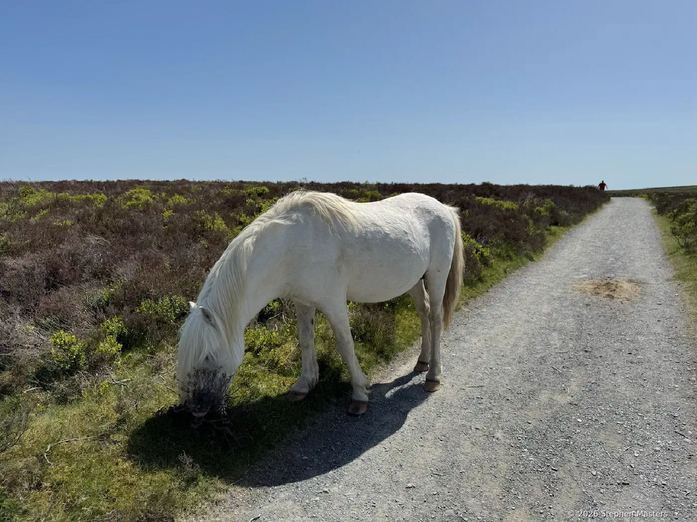
After a few gulps of water, I followed the stream and skirted the hill until the path led me to the heather covered hill above. I had a little walk around the top of that hill for the views, then made my way up to the narrow road that runs along the top of the ridge. Along there, I came across some of the wild ponies tha live up there. They’re not nervous at all - quite happy for people to be wandering past while they munch on heather.
That road leads to Pole Bank – the highest point on The Long Mynd. I came back off the hill and headed to the road and across it so that I could start making my way back. The route back starts out on grassy paths over the tops of the hills, which lead to a narrow rocky path that follows the side of a hill. There are some wonderfully twisted trees along here.
The bottom of the hill is close to Church Stretton, so I walked along the road there to the Hollybush Cafe for a bit of refreshment before the drive home.
Overall, it’s a great walk if you are comfortable doing that distance with a decent amount of climbing. If three hours is a bit too much, there are shorter loops to choose from if you don’t feel the need to get all the way up to Pole Bank.